

How to use this Chennai Metro guide
This Chennai guide organises the station list, interchange references and fare notes used by Bharat Metro Locator. For changes to operations or timings, consult Chennai Metro Rail before travelling.
Lines, interchanges and expansion notes
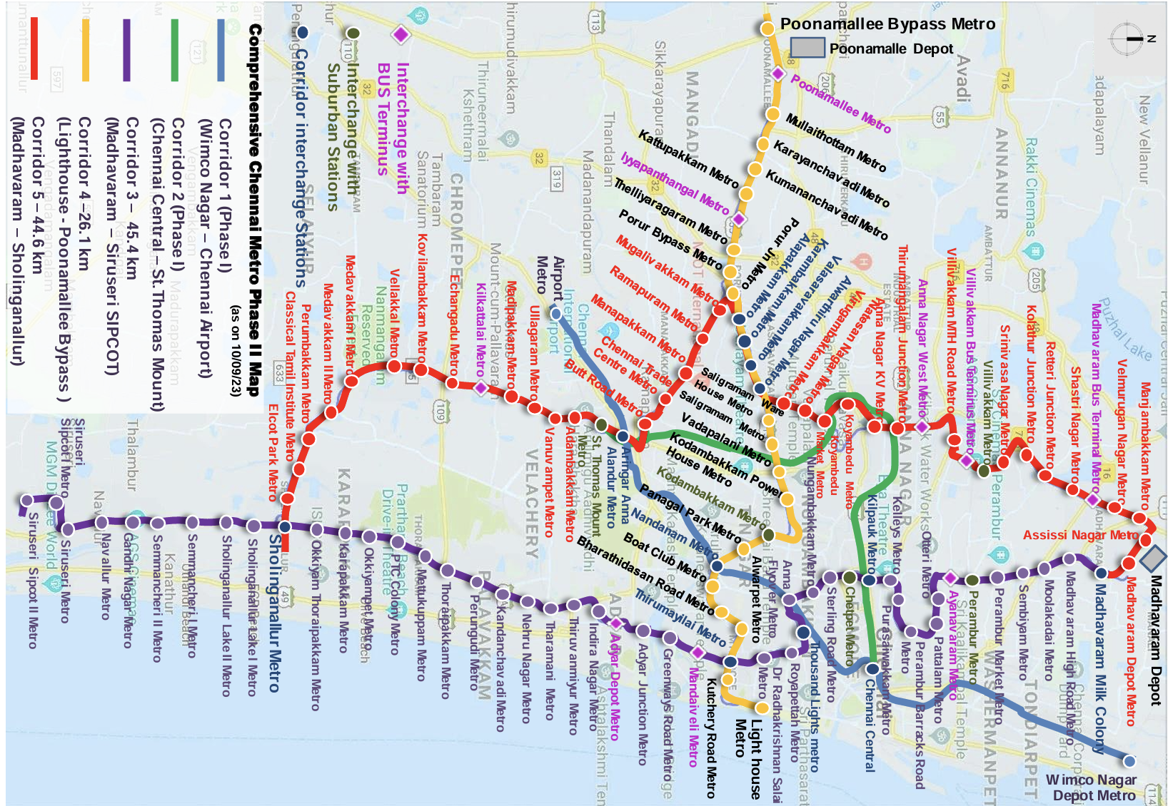
From the Blue Line connecting Wimco Nagar to Airport to the Green Line from Chennai Central to St. Thomas Mount, our interactive map provides station details, platform numbers, and exit-gate information.
Find the most useful station sequence
Enter your source and destination to get multiple route options ranked by travel time, interchanges, and walking distance, with a detailed Chennai Metro ticket price breakdown. Use the flip arrow in the route planner to quickly check return trains (e.g., from Airport to Koyambedu and back).
Fare and ticketing notes
The route view gives the configured Chennai fare reference, beginning at INR 10, and points to smart-card and QR-ticket options. Confirm the final amount and ticket rules with the operator.
Chennai Metro at a glance (2025)
- Total route length: 54.1 km across 2 operational lines
- Daily ridership: ~0.3 million passengers (April 2025 average)
- Key feature: Direct connectivity to Chennai International Airport
- Major interchange: Alandur, connecting Blue and Green Lines
Chennai Metro Phase 2 updates
Phase 2 will add 118.9 km of new tracks, including corridors like Madhavaram to Sholinganallur and Poonamallee to Parandur, with completion expected by 2028. Stay tuned for updates as new Chennai Metro stations open.